Articles, tools, and commentary on the latest in mycorrhizal research.


This article by Jinsu Elhance explores underground complexity, microbial mapping methods and his journey to becoming an Underground Astronaut.
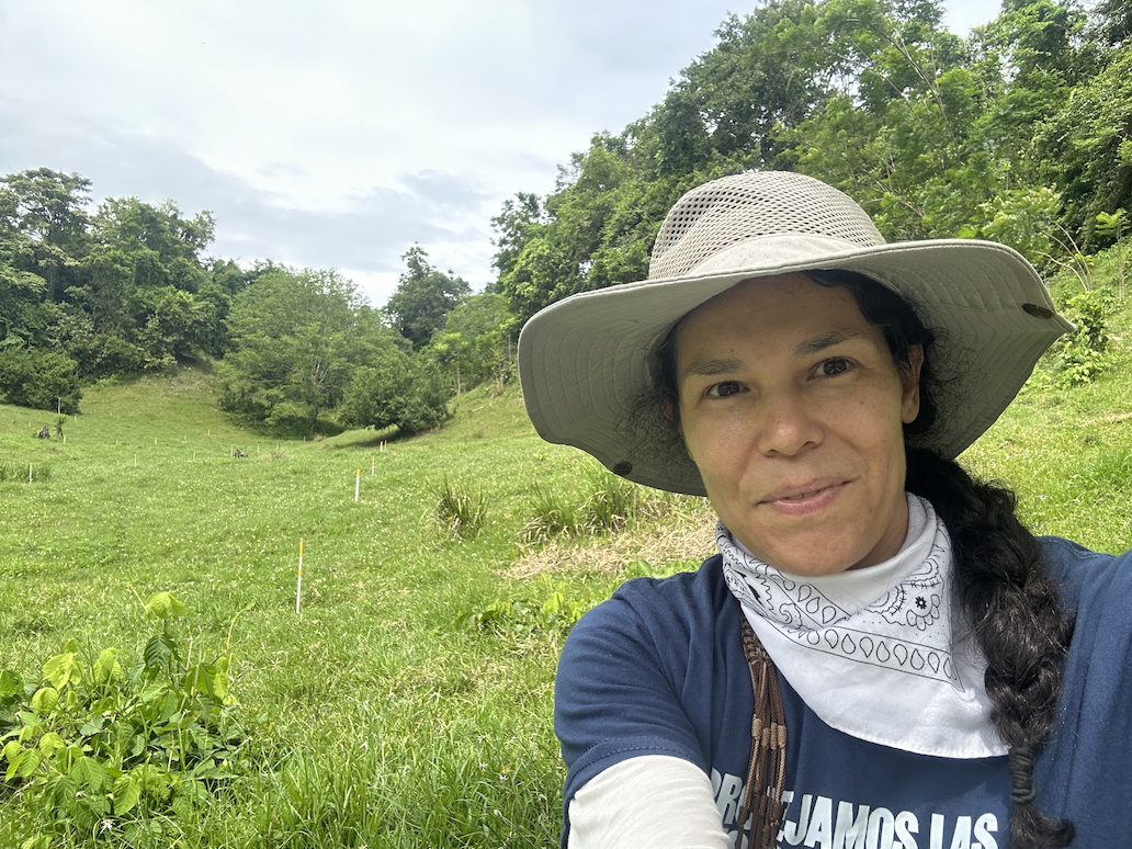
Rewilding Underground Ecosystems in the Magdalena River Valley in Colombia. Working to conserve and regenerate the last forest relics in a deforested area under pressure by land use change: cattle ranching, mining and oil drilling.
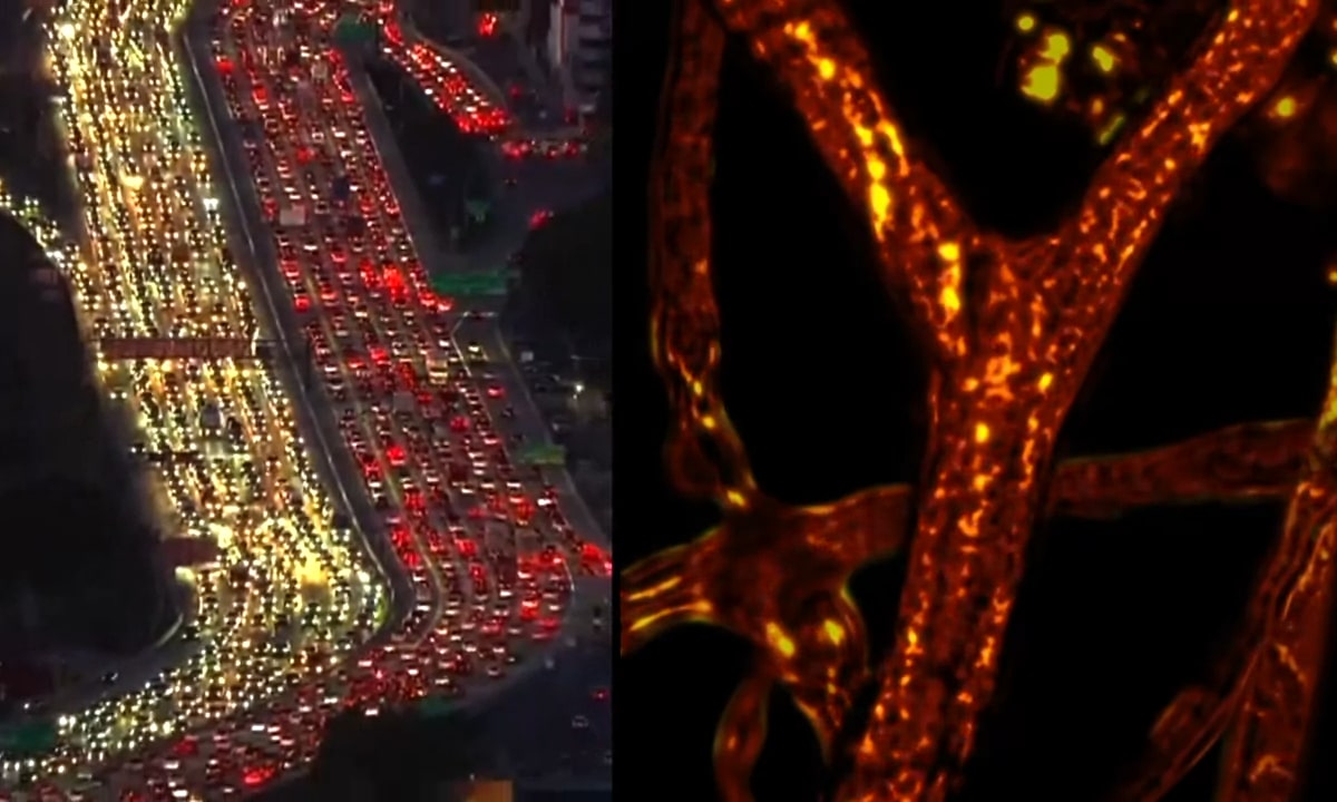
The paper is about mapping how AM fungi build and operate supply chains for underground nutrient exchange and trade in real-time.
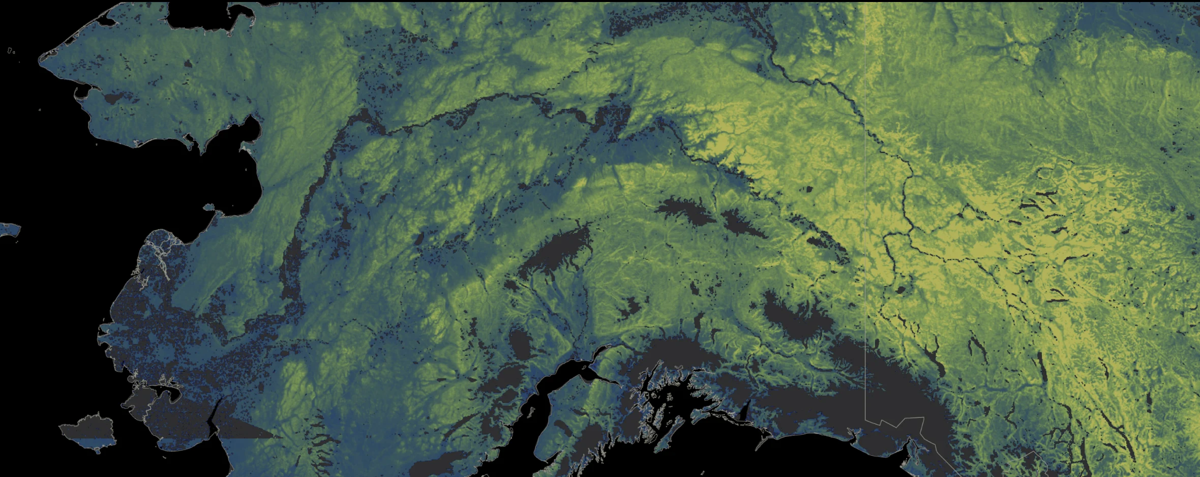
Using more than 2.8 billion fungal DNA sequences derived from soil samples collected across 130 countries, we have created the first high-resolution maps to predict mycorrhizal fungal biodiversity at a 1 km2 resolution across the planet.

Soil is more than just dirt; it is a living ecosystem teeming with over half of Earth’s species. Among its inhabitants are underground organisms that play critical roles in maintaining soil health and fertility. However, the biodiversity of these organisms is under threat from various human activities. This article delves into the tools available for assessing threats to soil biodiversity, with a focus on mycorrhizal fungi.


In February, 2024, SPUN and JR Biotek co-hosted the African Mycorrhizal Mapping and Metagenomics Workshop in Kumasi, Ghana in partnership with Oxford Nanopore Technologies (ONT) and CSIR - Crops Research Institute. The workshop was co-led by Dr. Bethan Manley, who sat down with workshop participant Dr. Jacob Ulzen of University of Ghana to talk about his experience.

In the race to map underground fungi before they are gone, it is imperative that we enlist the best mycorrhizal researchers from everywhere in the world, and we found we had a gap in the amount of research coming out of the Global South. In an effort to remedy this, we created the Underground Explorers program to support mycorrhizal researchers from the Global South, and underfunded countries.

Most mycorrhizal fungi live their entire lives underground – many of them don’t even make mushrooms, the fruiting bodies of fungi that pop up above the soil level. The hidden nature of these organisms can make studying them particularly challenging. For organisms like plants and animals, scientists can gather observational data, counting and recording or tagging study subjects. When it comes to belowground fungi and microbes, these surveys become more complicated.

How does SPUN choose locations for sampling expeditions? To produce the most valuable data, we make strategic decisions when we choose where to sample for mycorrhizal fungi. We prioritize regions that have unique characteristics and low sampling intensity — this way we make sure to collect samples in areas that will have the highest impact on our effort to map global mycorrhizal biodiversity.

Biodiversity mapping uses data to make predictions about the biodiversity across all of Earth’s ecoregions. With this kind of machine learning work there is always a degree of uncertainty. SPUN sees areas with high uncertainty as opportunities to “ground truth” our predictions — collecting real-life samples from areas where our model has made predictions allows us to check those predictions against the biodiversity we find and strengthens our models.

Human activities and climate change are threatening mycorrhizal fungi at a rate never before seen, but we lack the tools to locate where these threats are happening. To address this, we are using geo-spatial data to identify and quantify threats to underground biodiversity.

We've known for quite some time that carbon flows from plants into mycorrhizal fungi. It’s one of the central pieces to this type of plant-fungal symbiosis. But until now, we haven't had a good global estimate of how much that flow of carbon is. With this review, our goal was to synthesize all the data currently out there to try and better understand this overlooked component of the carbon cycle.


